HOT WEEK - Seguimos! Hasta 30% en importados + Envio gratis en compras mayores a $50.000  Ver más

menú

0
  • argentina
  • chile
  • colombia
  • españa
  • méxico
  • perú
  • estados unidos
  • internacional
portada World war i Illustrated Atlas: Campaigns, Battles & Weapons From 1914-1918 (en Inglés)
Formato
Libro Físico
Editorial
Idioma
Inglés
N° páginas
192
Encuadernación
Tapa Dura
ISBN13
9781852493875

World war i Illustrated Atlas: Campaigns, Battles & Weapons From 1914-1918 (en Inglés)

Professor Michael S Neiberg (Autor) · Amber Books · Tapa Dura

World war i Illustrated Atlas: Campaigns, Battles & Weapons From 1914-1918 (en Inglés) - Professor Michael S Neiberg

Libro Nuevo

$ 40.727

$ 58.182

Ahorras: $ 17.455

30% descuento
  • Estado: Nuevo
Origen: Estados Unidos (Costos de importación incluídos en el precio)
Se enviará desde nuestra bodega entre el Lunes 17 de Junio y el Miércoles 26 de Junio.
Lo recibirás en cualquier lugar de Argentina entre 1 y 3 días hábiles luego del envío.

Reseña del libro "World war i Illustrated Atlas: Campaigns, Battles & Weapons From 1914-1918 (en Inglés)"

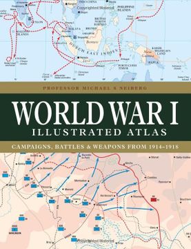
With a new cover design and updated introduction, this complete atlas provides an invaluable work of reference for both the general reader and the serious student of World War I. World War I Illustrated Atlas is a comprehensive visual guide to this complex conflict. In fine detail, it plots the exact course of the land, sea, and air campaigns, enabling the reader to trace the ebb and flow of the fortunes of all sides. With more than 180 full-color maps, every theater of war is covered--from the Western Front to Penang, from Gallipoli to Galicia, from Dogger Bank to Dalmatia, from Romania to Rhodesia, and from the Falklands to Togo and the Sinai desert. All the maps have been specially commissioned from an expert cartographer. Each map is designed to highlight a particular aspect of the war--thus maps vary in shape and size, with some giving a global perspective while others depict the exact movement of armed forces on land, sea, or in the air. Battles such as Jutland, the Somme, Cambrai, and the Gallipoli campaign are shown in great detail. All maps are accompanied by an explanatory key.

Opiniones del libro

Ver más opiniones de clientes
  • 0% (0)
  • 0% (0)
  • 0% (0)
  • 0% (0)
  • 0% (0)

Preguntas frecuentes sobre el libro

Todos los libros de nuestro catálogo son Originales.
El libro está escrito en Inglés.
La encuadernación de esta edición es Tapa Dura.

Preguntas y respuestas sobre el libro

¿Tienes una pregunta sobre el libro? Inicia sesión para poder agregar tu propia pregunta.

Opiniones sobre Buscalibre

Ver más opiniones de clientes