Pasaporte a Nuevas Historias: Recorré el mundo entre libros hasta 55% OFF en importados  Ver más

Enviar a
C.A.B.A., Ciudad Autónoma de Buenos Aires
0
  • argentina
  • chile
  • colombia
  • españa
  • méxico
  • perú
  • estados unidos
  • internacional

Selecciona tu país

América

Europa

Resto del mundo

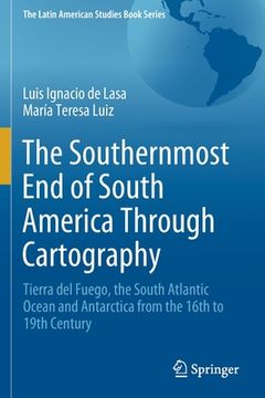
portada The Southernmost end of South America Through Cartography: Tierra del Fuego, the South Atlantic Ocean and Antarctica From the 16Th to 19Th Century (en Inglés)
Formato
Libro Físico
Editorial
Idioma
Inglés
N° páginas
180
Encuadernación
Tapa Blanda
Dimensiones
23.4x15.6x1 cm
Peso
0.28 kg.
ISBN13
9783030658816

The Southernmost end of South America Through Cartography: Tierra del Fuego, the South Atlantic Ocean and Antarctica From the 16Th to 19Th Century (en Inglés)

Luis Ignacio de Lasa (Autor) · María Teresa Luiz (Autor) · Springer · Tapa Blanda

The Southernmost end of South America Through Cartography: Tierra del Fuego, the South Atlantic Ocean and Antarctica From the 16Th to 19Th Century (en Inglés) - de Lasa, Luis Ignacio ; Luiz, María Teresa

Libro Nuevo Importado
Envío: 14 a 20 días háb.
$ 464.887$ 232.444
-50%
Costos de importación incluídos en el precio ✅
Libro Nuevo

Quedan más de 100 unidades

$ 232.444
Llega entre el 24 Sep y el 02 Oct a C.A.B.A., Ciudad Autónoma de Buenos Aires. Seleccionar ubicación

Reseña del libro "The Southernmost end of South America Through Cartography: Tierra del Fuego, the South Atlantic Ocean and Antarctica From the 16Th to 19Th Century (en Inglés)"

This volume describes the construction of the territorial identity of the southern end of South America and analyzes the cartographic territorialization of Patagonia, Tierra del Fuego and the "Terra Australis" continent. Different spatial representations and territorial nature coexisted in this process as a result of the spatial interpretation and value modes as well as the projects and strategies of various actors. The book discusses the formal and symbolic incorporation to the Spanish dominion and its inclusion in the imperial design built over a new image of the world. Examining Jesuit cartography it considers both the indigenous territoriality and the dynamics of relations between natural and social components in the continental hinterland. The process of cartographic differentiation for this southern Atlantic region is analyzed in the framework of early Antarctic exploration and competing use of navigation routes and maritime resources. The book emphasizes the role geopolitical and economic interests play in these developments. The formation of territorialities of various origins has particular contents and logic, which are built upon imaginary subordination to political and economic interests. Cartographic language in the 19th century, associated with political and commercial motivations and the (British) imperial ideology, stimulated the territorial expansion. The book argues why in the late 1800's this was an important factor in the integration process of the southern indigenous territories and the national territoriality.

Opiniones del libro

Preguntas frecuentes sobre el libro

Todos los libros de nuestro catálogo son Originales.
El libro está escrito en Inglés.
La encuadernación de esta edición es Tapa Blanda.

Preguntas y respuestas sobre el libro

¿Tienes una pregunta sobre el libro? Inicia sesión para poder agregar tu propia pregunta.

Opiniones sobre Buscalibre

Ver más opiniones de clientes