Compartir
PHAST Version 2?A Program for Simulating Groundwater Flow, Solute Transport, and Multicomponent Geochemical Reactions (en Inglés)
Kenneth L. Kipp
(Autor)
·
Scott R. Charlton
(Autor)
·
David L. Parkhurst
(Autor)
·
Createspace Independent Publishing Platform
· Tapa Blanda
PHAST Version 2?A Program for Simulating Groundwater Flow, Solute Transport, and Multicomponent Geochemical Reactions (en Inglés) - Kipp, Kenneth L. ; Charlton, Scott R. ; Parkhurst, David L.
$ 48.783
$ 60.979
Ahorras: $ 12.196
Elige la lista en la que quieres agregar tu producto o crea una nueva lista
✓ Producto agregado correctamente a la lista de deseos.
Ir a Mis Listas
Origen: Estados Unidos
(Costos de importación incluídos en el precio)
Se enviará desde nuestra bodega entre el
Martes 20 de Agosto y el
Martes 03 de Septiembre.
Lo recibirás en cualquier lugar de Argentina entre 1 y 3 días hábiles luego del envío.
Reseña del libro "PHAST Version 2?A Program for Simulating Groundwater Flow, Solute Transport, and Multicomponent Geochemical Reactions (en Inglés)"
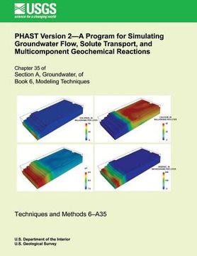
The computer program PHAST (PHREEQC And HST3D) simulates multicomponent, reactive solute transport in three-dimensional saturated groundwater flow systems. PHAST is a versatile groundwater flow and solute-transport simulator with capabilities to model a wide range of equilibrium and kinetic geochem- ical reactions. The flow and transport calculations are based on a modified version of HST3D that is restricted to constant fluid density and constant temperature. The geochemical reactions are simulated with the geochemical model PHREEQC, which is embedded in PHAST. Major enhancements in PHAST Version 2 allow spatial data to be defined in a combination of map and grid coordinate systems, independent of a specific model grid (without node-by-node input). At run time, aquifer properties are interpolated from the spatial data to the model grid; regridding requires only redefinition of the grid without modification of the spatial data.

