Compartir
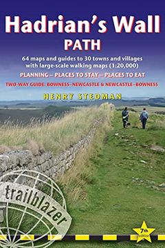
Hadrian's Wall Path: British Walking Guide: Two-Way: Bowness-Newcastle-Bowness - 64 Large-Scale Walking Maps (1:20,000) & Guides to 30 Town (en Inglés)
Henry Stedman
(Autor)
·
Trailblazer Publications
· Tapa Blanda
Hadrian's Wall Path: British Walking Guide: Two-Way: Bowness-Newcastle-Bowness - 64 Large-Scale Walking Maps (1:20,000) & Guides to 30 Town (en Inglés) - Stedman, Henry
$ 26.642
$ 53.284
Ahorras: $ 26.642
Elige la lista en la que quieres agregar tu producto o crea una nueva lista
✓ Producto agregado correctamente a la lista de deseos.
Ir a Mis Listas
Origen: Estados Unidos
(Costos de importación incluídos en el precio)
Se enviará desde nuestra bodega entre el
Jueves 13 de Junio y el
Lunes 24 de Junio.
Lo recibirás en cualquier lugar de Argentina entre 1 y 3 días hábiles luego del envío.
Reseña del libro "Hadrian's Wall Path: British Walking Guide: Two-Way: Bowness-Newcastle-Bowness - 64 Large-Scale Walking Maps (1:20,000) & Guides to 30 Town (en Inglés)"
All-in-one guide to walking Hadrian's Wall Path National Trail. Hadrian's Wall Path, 84 miles from end to end, follows the course of northern Europe's largest surviving Roman monument, a 2nd-century fortification built - in the border country between England and Scotland - on the orders of the Emperor Hadrian in AD122. Opened in 2003, the path crosses the beautiful border country between England and Scotland. It is the first National Trail to follow the course of a UNESCO World Heritage Site. This week-long walk is regarded as one of the least challenging National Trails.8 town plans and 59 large-scale walking maps - at just under 1:20,000 - showing route times, places to stay, points of interest and much morePlus 6 stage maps and 1 overview mapItineraries for all walkers - whether walking the route in its entirety over seven to eight days or sampling the highlights on day walks and short breaksPractical information for all budgets - camping, bunkhouses, hostels, B&Bs, pubs and hotels; where to stay, where to eat, what to see, plus detailed street plansComprehensive public transport information - for all access points on the Hadrian's Wall Path.Flora and fauna - four page full color flower guide, plus an illustrated section on local wildlifeGreen hiking - understanding the local environment and minimizing our impact on itNewcastle city guideGPS waypoints. These are also downloadable from the Trailblazer website.Includes extra colour sections: 16pp colour introduction and 16pp of colour mapping for stage sections (one stage per page) with trail profiles.

