¡Todavía hay mucho por celebrar! Hasta 50% OFF + 3 cuotas sin interés  Ver más

Enviar a
C.A.B.A., Ciudad Autónoma de Buenos Aires
0
  • argentina
  • chile
  • colombia
  • españa
  • méxico
  • perú
  • estados unidos
  • internacional

Selecciona tu país

América

Europa

Resto del mundo

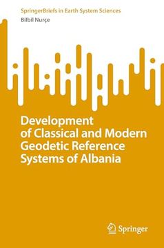
portada Development of Classical and Modern Geodetic Reference Systems of Albania (en Inglés)
Formato
Libro Físico
Editorial
Idioma
Inglés
N° páginas
105
Encuadernación
Tapa Blanda
Dimensiones
23.4x15.4x1 cm
Peso
0.23 kg.
ISBN13
9783031253652
N° edición
1

Development of Classical and Modern Geodetic Reference Systems of Albania (en Inglés)

Bilbil Nurçe (Autor) · Springer · Tapa Blanda

Development of Classical and Modern Geodetic Reference Systems of Albania (en Inglés) - Nurçe, Bilbil

Libro Nuevo Importado
Envío: 18 a 24 días háb.
$ 199.500$ 99.750
-50%
Costos de importación incluídos en el precio ✅
Libro Nuevo

Quedan más de 100 unidades

$ 99.750
Llega entre el 23 Sep y el 01 Oct a C.A.B.A., Ciudad Autónoma de Buenos Aires. Seleccionar ubicación

Reseña del libro "Development of Classical and Modern Geodetic Reference Systems of Albania (en Inglés)"

This book addresses the problems of mathematical relations between global and classical coordinate references from the practical applications point of view. It presents a large cartographic and numerical information set, which provides great values for practical and academical use based on the classical Albanian coordinative reference (ALB1986/ALB1987). This information is reflected from the positional point of view in the new modern Albanian satellite reference ALBPOS (Albanian Positioning System) or ALBCORS (Albanian Continuous Operation Reference Stations System). The main purpose of this Monograph is to summarize coordinative references applied in Albania in different periods, both classical and modern. Relevant transformation models between traditional/classical reference ALB1986 / ALB1987 and GNSS satellite reference are presented. The book furthermore recommends the mathematical models of the relationship in plan and height, between the Albanian classical reference and the global/European coordinate references (ITRF, EUREF). It serves to professionals involved in fundamental geodetic works as well as all working with GNSS or developing GIS applications.

Opiniones del libro

Preguntas frecuentes sobre el libro

Todos los libros de nuestro catálogo son Originales.
El libro está escrito en Inglés.
La encuadernación de esta edición es Tapa Blanda.

Preguntas y respuestas sobre el libro

¿Tienes una pregunta sobre el libro? Inicia sesión para poder agregar tu propia pregunta.

Opiniones sobre Buscalibre

Ver más opiniones de clientes