Compartir
Cleveland Way: British Walking Guide: Planning, Places to Stay, Places to Eat; Includes 48 Large-Scale Walking Maps (British Walking Guides) (en Inglés)
Henry Stedman (Autor)
·
Trailblazer Editions
· Tapa Blanda
Cleveland Way: British Walking Guide: Planning, Places to Stay, Places to Eat; Includes 48 Large-Scale Walking Maps (British Walking Guides) (en Inglés) - Henry Stedman
$ 27.705
$ 55.411
Ahorras: $ 27.705
Elige la lista en la que quieres agregar tu producto o crea una nueva lista
✓ Producto agregado correctamente a la lista de deseos.
Ir a Mis Listas
Origen: Estados Unidos
(Costos de importación incluídos en el precio)
Se enviará desde nuestra bodega entre el
Jueves 13 de Junio y el
Lunes 24 de Junio.
Lo recibirás en cualquier lugar de Argentina entre 1 y 3 días hábiles luego del envío.
Reseña del libro "Cleveland Way: British Walking Guide: Planning, Places to Stay, Places to Eat; Includes 48 Large-Scale Walking Maps (British Walking Guides) (en Inglés)"
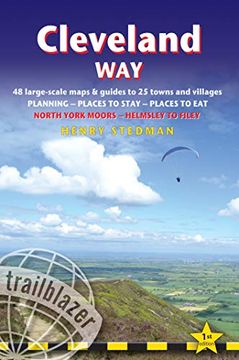
A 110-mile National Trail, the Cleveland Way is set in the beautiful wild countryside of the North York Moors National Park. It runs from Helmsley near Thirsk around the western edge of the park to reach the coast at Saltburn-by-the-Sea. It then continues along the eastern edge of the park south down the coast through Whitby, Robin Hood's Bay and Scarborough to finish in Filey. Combining moorland and coast there's wonderful scenic variety to this walk, with crumbling castles and idyllic fishing villages to explore. This is an all-in-one hiking route guide, maps and accommodations for the 110-mile Cleveland Way, set in the North York Moors National Park. Includes 48 large-scale walking maps (3 1/8 inches to 1 mile); 8 town maps and 12 overview maps. Full details of all accommodations and campsites, restaurants and pubs; plus full public transport information. Includes day-walks.8 town plans and 48 large-scale walking maps – at just under 1:20,000 – showing route times, places to stay, points of interest and much morePlus 10 overview mapsItineraries for all walkers – whether walking the route in its entirety over seven to eight days or sampling the highlights on day walks and short breaksPractical information for all budgets – camping, bunkhouses, hostels, B&Bs, pubs and hotels – where to stay, where to eat, what to see, plus detailed street plansComprehensive public transport information – for all access points on the path.Flora and fauna – four page full color flower guide, plus an illustrated section on local wildlifeGreen hiking – understanding the local environment and minimizing our impact on itGPS waypoints. These are also downloadable from the Trailblazer website.Includes extra colour sections: 16pp colour introduction and 10pp of colour mapping for stage sections (one stage per page) with trail profiles.

