Compartir
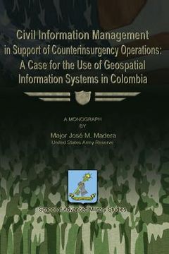
Civil Information Management in Support of Counterinsurgency Operations - A Case for the Use of Geospatial Information Systems in Columbia (en Inglés)
Jose M. Madera
(Autor)
·
Createspace Independent Publishing Platform
· Tapa Blanda
Civil Information Management in Support of Counterinsurgency Operations - A Case for the Use of Geospatial Information Systems in Columbia (en Inglés) - Madera, Jose M.
$ 35.682
$ 59.469
Ahorras: $ 23.788
Elige la lista en la que quieres agregar tu producto o crea una nueva lista
✓ Producto agregado correctamente a la lista de deseos.
Ir a Mis Listas
Origen: Estados Unidos
(Costos de importación incluídos en el precio)
Se enviará desde nuestra bodega entre el
Lunes 19 de Agosto y el
Lunes 02 de Septiembre.
Lo recibirás en cualquier lugar de Argentina entre 1 y 3 días hábiles luego del envío.
Reseña del libro "Civil Information Management in Support of Counterinsurgency Operations - A Case for the Use of Geospatial Information Systems in Columbia (en Inglés)"
Civil Information Management Systems (CIMS) are emerging as a resource which allows commanders to build a Common Operational Picture (COP) upon which to base their operational planning and execution. Geospatial Information Systems (GIS) are a type of CIMS. GIS have been underutilized by the military which traditionally uses geographic data as cartographic and imagery support for military intelligence and maneuver purposes. This monograph provides a framework for determining the value of using GIS as a tool in counterinsurgency (COIN). Given the crucial role that geography plays in the Colombian internal conflict, this case presents a unique opportunity to evaluate the capabilities that GIS offer. Recent experience shows that, despite achieving a significant measure of success on the battlefield, the Armed Forces of the United States of America face continuing challenges in adapting to the requirements of a long term global struggle. The nature of the current conflict or "Long War" requires effective engagement, coordination, and collaboration with interagency and international partners. Counterinsurgency efforts in Colombia are an example of this environment, and this study concludes that the applicability of GIS in that context posits the desirability of applying these capabilities in other counterinsurgency settings. Based upon the above, two proposals are made; (1) further developing and analyzing existing GIS data sets for Colombia by applying a Civil Information collection methodology and (2) developing and integrating a robust Civil Information based GIS capability within the U.S. Joint Forces supporting counterinsurgency efforts in Colombia and elsewhere.
- 0% (0)
- 0% (0)
- 0% (0)
- 0% (0)
- 0% (0)
Todos los libros de nuestro catálogo son Originales.
El libro está escrito en Inglés.
La encuadernación de esta edición es Tapa Blanda.
✓ Producto agregado correctamente al carro, Ir a Pagar.

